Spectacular views from Odaka-kannonTemple in KomonoTown and Mt. Odaka that can be climbed from the back!
掲載日:2023.10.10
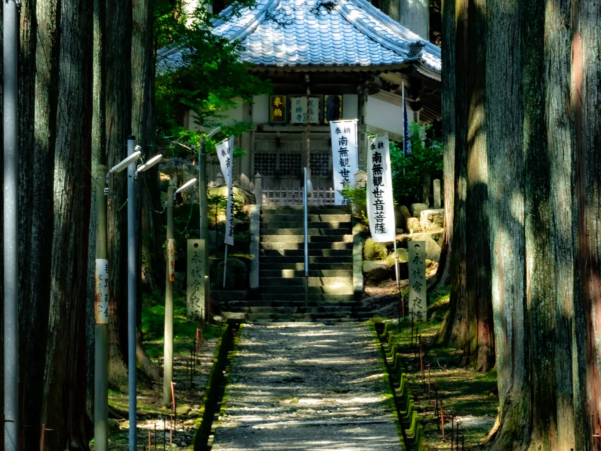
I would like to introduce you to Odaka Kannon, located in Komono-cho, Mie KomonoTown, where you can feel a mystical Odaka-kannonTemple with 300-year-old cypress trees on both sides, and Mt. Odaka that you can climb from there!
Why not take a look at this article as a reference?
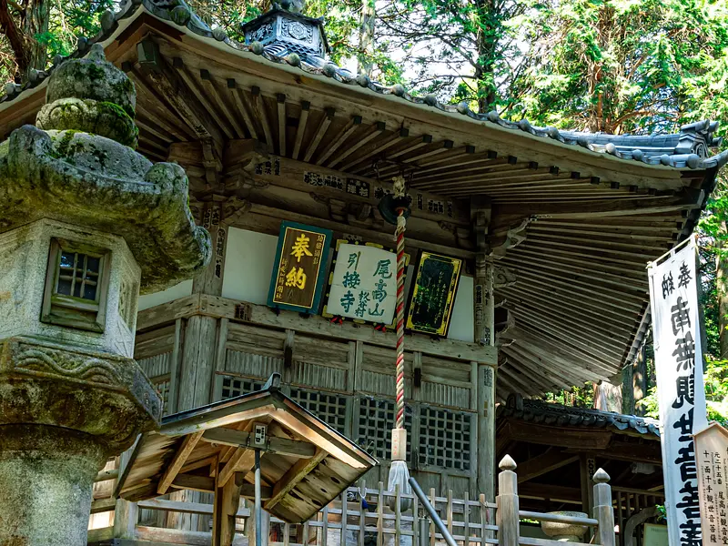
What is Odaka-kannonTemple?
Odaka Kannon is located at the foot of Mt. Shakagatake (1029m) in the Suzuka Mountains, which connects the border between Mie Prefecture and Shiga Prefecture, and has a long, straight approach through a cypress forest that leaves a Odaka-kannonTemple impression.
It is said that it began when En no Gyoja enshrined the Senju Kannon in Mt. Shakagatake.
In the early Heian period, a temple and pagoda were erected at the foot of the mountain, and Odakasan Injoji Temple was opened.
It is said that it flourished after that and was a large temple with many temples built within its vast grounds.
However, it was reduced to ashes by Oda Nobunaga's military fire and declined.
In 1887, it was given the name of Jiganji Temple in Ise, and Jiganji Temple was rebuilt, and Odaka-kannonTemple passes down its history as the inner temple of Jiganji Temple.
The charm of Otakayama!


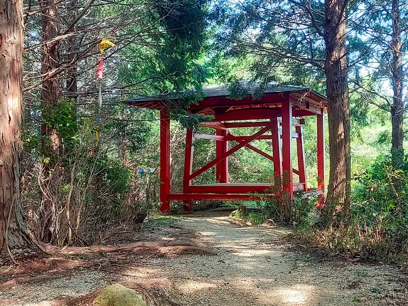


The trailhead for Mt. Odaka is behind Odaka-kannonTemple!
I climbed the mountain from the hiking course and descended from the overlook course!
Features of the hiking course
- Although it is a low mountain, there is also a small rocky area with a rope area, making it a perfect course for those who like activities.
- The slope is not too steep and it is easy to walk.
Features of the view course
- There is a spot just before the top of the mountain where you can enjoy the view. (The 5th photo was taken from the opposite side with a wider view. There is also a place to sit made of wood.)
- Walking along the mountain trail lined with cedar trees will make you feel like you are one with nature.
The altitude is about 533m, making it a course that even beginners can climb!
Points to note when climbing
1. Walk while checking your current location
Maps and compasses are not something you look at when you get lost. Use GPS and map apps to check each point, such as peaks, mountain passes, junctions, and good viewpoints.
2. Frequently adjust your body temperature
In order to prevent hypothermia and heat stroke and walk comfortably in the mountains, you need to frequently regulate your body temperature. If you feel hot during the activity, take off one layer of clothing, and if you feel cold, put on an outer layer or warm clothing. Don't say, "Maybe next time I take a break." It is important to do this right away.
3. Take breaks as needed
When climbing, it is often said that it is a good idea to walk for 40 minutes to an hour and then take a 10 minute break, but this is not always necessary. This is just a guideline. You can walk for more than an hour if you have the time, but if you feel tired, take a break early. When the weather is bad, taking a break can cause your body to cool down, so it may be better to continue walking at a comfortable pace without taking a break.
4. Replenish energy and hydration
When you become sharibatate (a state of low physical strength), your concentration becomes distracted, increasing the risk of falls, falls, and getting lost. Lack of water can also cause hypothermia, heatstroke, and altitude sickness. Make sure to frequently replenish your energy sources and water while you are active. We recommend using hydration or carrying food in your pocket so you can replenish your energy while walking.
5. Don't overdo it
Not everything goes according to plan while climbing. Rather, it is more common for some type of accident to occur, such as bad weather or poor health. If you make the wrong decision at that time, you could end up in the worst possible situation. In the mountains, it is important not to force yourself to follow a plan, but to be flexible, such as evacuating to a nearby mountain hut or descending from an escape route.
summary
We introduced key points for enjoying mountain climbing safely and securely, such as checking your current location, regulating your body temperature, taking breaks, and eating active foods. At times, you may find yourself rushing to work without taking breaks, thinking, "Hurry, hurry." But mountain climbing is not a competition. Please enjoy the mountain at your own pace, taking into consideration your physical strength, current conditions, and weather conditions.
A little detour to play in the water and see the waterfall!


If you go down the mountain on the view course, you can go to the road that leads to Uotome Falls!
I was able to refresh myself by diving into the waterfall basin!
The waterfall is also a great spot to take good photos!
The depth here was about 60cm.
*When playing in water such as waterfalls, please be careful as the current is fast and rocks can be slippery.
*This photo was taken on September 16, 2023.
Parking & Details

address
〒510-1326 Sugitani, Komono-cho, Mie-gun, Mie KomonoTown
telephone number
059-396-0078 (Odaka Tourism Association)
Access by car
・7 km from the Shin-Meishin Expressway "Komono IC" via National Route 477 and Prefectural Route 762, parking lot at the entrance of Odakayama Kannon-do
parking
·free
・There are clean restrooms on site.
・There are also several vending machines.
I'll also post some photos I posted on Instagram that I'd like you to see on a more impressive big screen! Please also take a look.
View this post on Instagram
location information