A flock of white sheep appears on the mountain! We will introduce the popular Suzuka Seven Mountains Ryugatake mountain climbing, which is full of fresh spring greenery, along with recommended routes!
In InabeCity, Mie Prefecture, there is Ugakei, a valley blessed with beautiful nature. Among them, Ryugatake, known as one of the Suzuka Seven Mountains, is bustling with many climbers due to the recent mountain climbing boom. A flock of white sheep appears on Ryugatake! Based on this information, we went to cover climbing Ryugatake! Will a flock of white sheep actually appear on Ryugatake? We will tell you about the charm of climbing Ryugatake!
Article production / Mie Travel Ambassador Yamaico!
- What exactly are the "Shiroyashio" white sheep, the flock of white sheep on top of the mountain?
- What kind of mountain is Ryugatake?
- Introduction of climbing routes
- A report on climbing Mt. Ryugatake,where you can see a flock of white sheep and a spectacular view
- If you come to Ugakei for sightseeing, be sure to visit this place! Let us introduce you to "Ryu no Koba"!
- How was it?
- Access information
What exactly are the "Shiroyashio" white sheep, the flock of white sheep on top of the mountain?
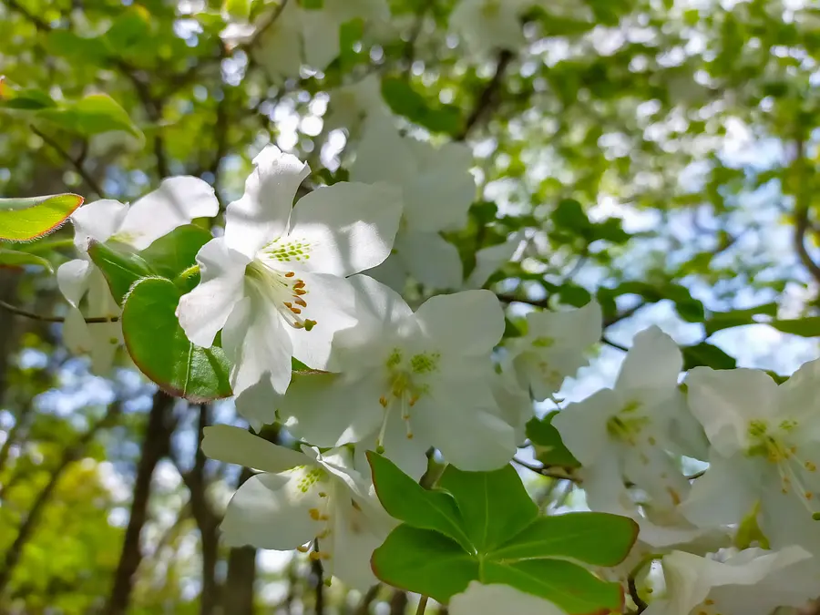
"Shiroyashio" is a plant of the Ericaceae family that grows in the high mountain regions of Japan. It grows on mountain slopes and rocky areas. From May to June, one or two white flowers bloom from the flower buds at the end of the branches along with new leaves. It is also called "Goyo Tsutsuji" (five-leaf azalea) because five leaves grow in whorls at the end of the branches.
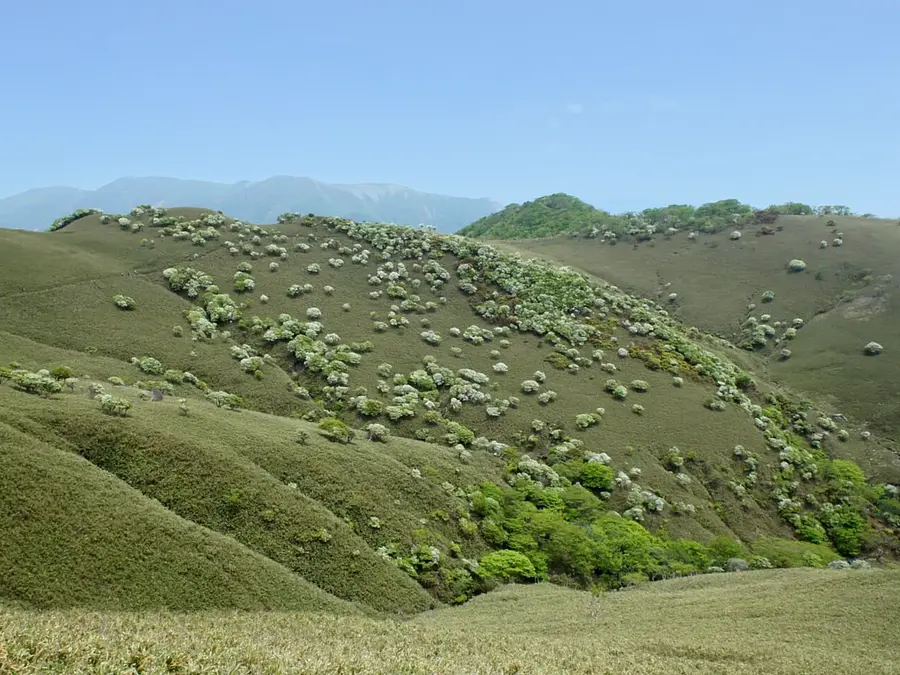
When the flowers are in full bloom, the grassland looks as if a large flock of sheep has appeared, and many climbers visit Ryugataka to see the white sheep.
There are other mountains in Mie Prefecture, such as Mt.Gozaisho, where you can see the white rhododendrons, and even all over Japan, but Ryugataka is the only place where so many white rhododendrons grow naturally and they are also known as "white sheep"!
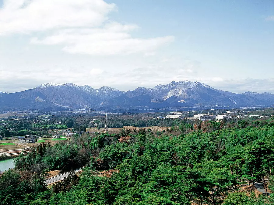
What kind of mountain is Ryugatake?
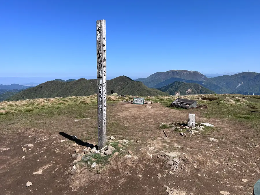
Ryugatake is a mountain located in the center of the Suzuka Mountains, which straddles Inabe City, InabeCity and Higashiomi City, Shiga Prefecture. With an elevation of 1,099m, it is one of the most popular mountains in the Suzuka Seven Mountains. The summit is a plain, and you can enjoy a 360° panoramic view.
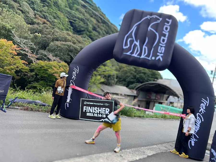
In the fall of 2023, InabeCity first trail running competition will be held, making this a mountain that can be enjoyed not only for hiking but also for trail running.
As an aside, I participated in that race and managed to complete it safely!!
Introduction of climbing routes
Let me introduce you to the hiking route this time!
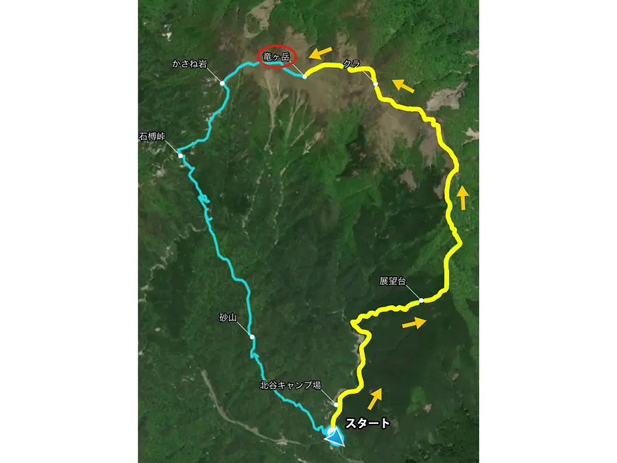
The route this time starts from the Ugakei Tourist Information Center, passes through the Kitakawachi Forest Road, and heads for the summit from the Ensetsu Ridge entrance. The climb to the summit takes about 3 hours, and the descent takes about 2.5 hours.
There is a slightly steep slope before you reach the ridge, but the views once you reach the ridge are spectacular, making this a popular route.
Things you should always keep in mind when climbing
Mountain climbing is inherently dangerous. Even if it is a low mountain,
Please follow good manners so you can have a safe and enjoyable mountain climbing!
- 《Precautions for climbing》
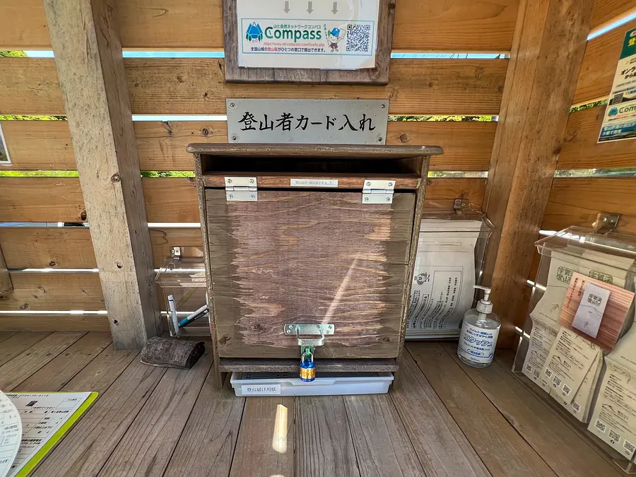
- *Make a reasonable mountain climbing plan in advance! Also, be sure to submit a mountain climbing report to the nearest police station or mountain climbing post before the day of your climb!
- *Make sure to take good care of your health and build up your physical strength! Also, if you are not feeling well, please cancel or postpone your mountain climbing.
- *Wear clothing and trekking shoes suitable for mountain climbing! Be sure to prepare the necessary water, food, rain gear, cold weather clothing, medicines, and first aid equipment that you will need while climbing.
- *Check the weather information just before climbing. If the weather is not good or bad weather is predicted, please cancel the climb.
- *We also recommend taking out mountain insurance just in case.
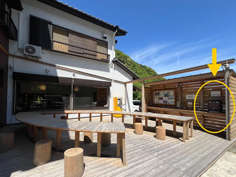
Please feel free to use the mountain climbing post located in the outdoor rest area of the Ugakei Tourist Information Center.
Here is a report on climbing Mt. Ryugataka, where you can see flocks of white sheep and spectacular views!
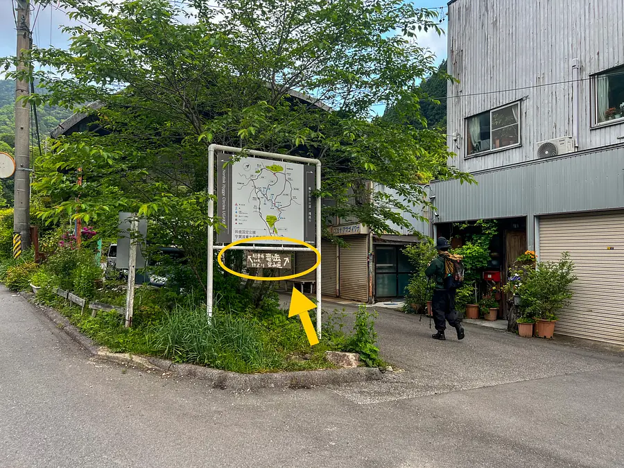
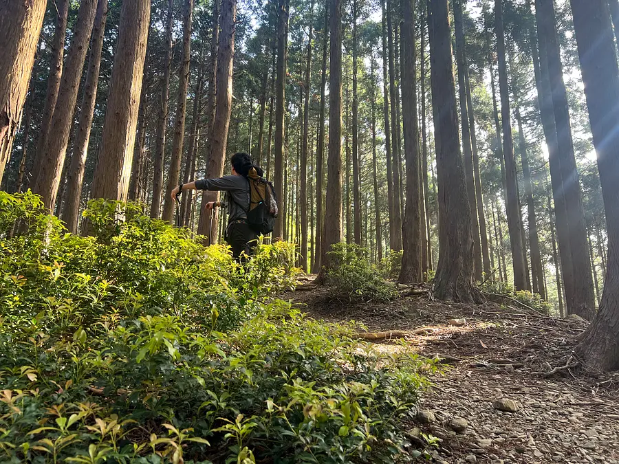
The hike starts from the Kitakawachi forest road next to the Ugakei Tourist Information Center.
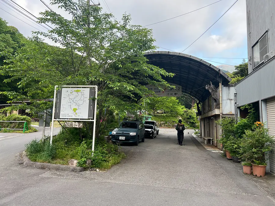
Let's go in the direction of the arch-shaped building. There is also a sign for the Ryugatake hiking trail under the guide sign, so follow the sign.
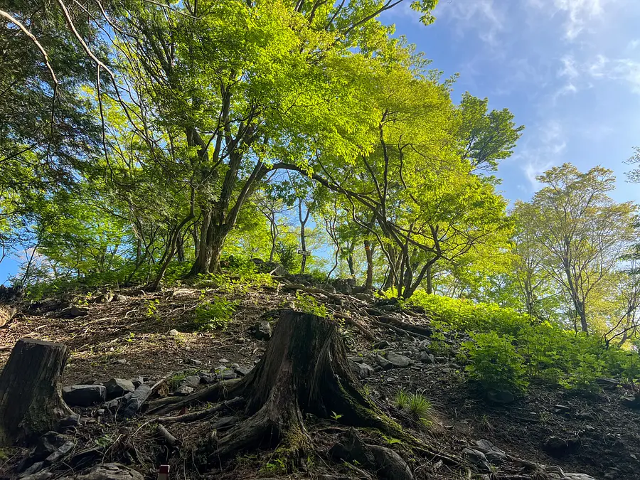
This is the view as soon as we started walking. The fresh greenery is so beautiful at this time of year!

From the start to the trailhead, the trail is a forest road, so you will walk on a paved road for a while. After about 15 minutes of walking, you will come across the spring water "Dragon's Drops" from the mountain of Ryugatake.

*Please refrain from drinking water or washing your hands due to the risk of echinococcosis.
From the Ryu no Shizuku site, it takes about 10 minutes to reach the entrance to the Excursion Ridge hiking trail.
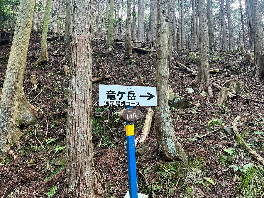
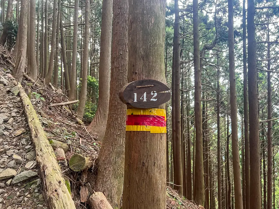
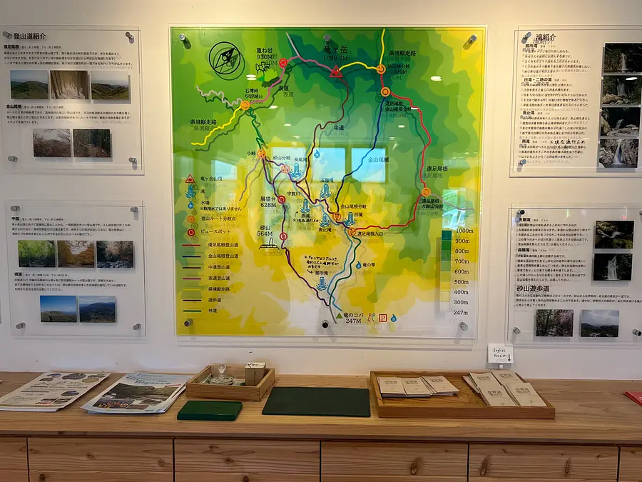
The number written under the sign in this photo is the climbing location confirmation number and corresponds to the number on the Ugakei climbing map which you can get at the Ugakei Tourist Information Center.
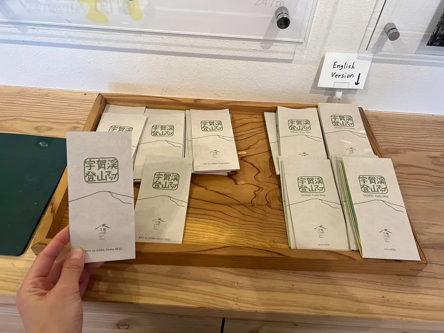

The Ugakei hiking map is easy to understand, with illustrations of the scenery and dangerous spots. It is very convenient to have it along with a map such as the YAMAP app. You can also check out the Ugakei hiking map on the Tatsunokoba website!
Ryu no Koba Ugakei Tourist Information Center Homepage (External link)
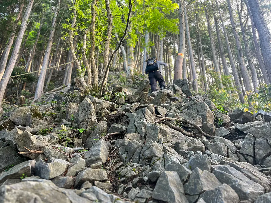
From the entrance to the excursion ridge, the path continues up a steep slope for a while.
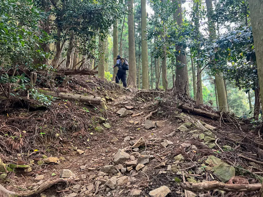
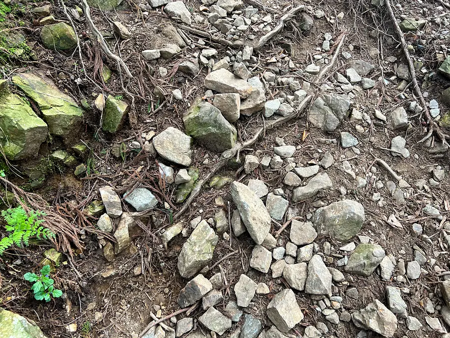
The ground looks like this.
The path continues going through the trees.
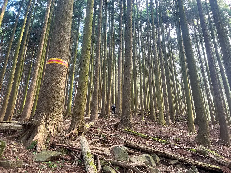
If you get lost, use the trail location confirmation numbers or the red and orange tape as guides.
You may find pink tape or other markings posted, but please be aware that the purpose of the tape varies depending on who put it up.
Although the slope is steep, there are gentler areas at times, so you can take breaks along the way. When taking a break, be considerate of other climbers and rest in a place that does not block the path of other climbers.
On this day, we started climbing at 6:00 in the morning and reached an altitude of about 600m in about an hour. The morning sun was shining through the gaps between the trees, creating a truly fantastic view!
A few minutes from the resting spot we arrived at a rocky mountain at an altitude of 634m. As we climbed the rocky mountain and looked to the left in the direction of travel, the peak of Ryugatake came into view.
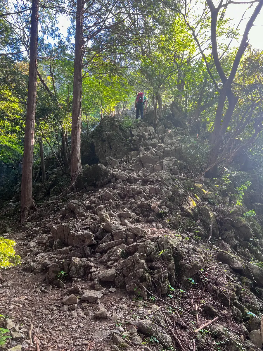
After descending the rocky mountain, you will then ascend into the Cullenveld area, where limestone formations can be seen.
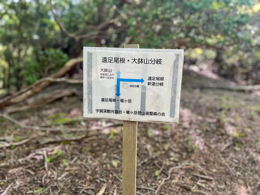
As you climb through the Karenfeld area, you will reach the fork in the road to the excursion ridge and the new trail. Here, the steep slope ends.
Continue towards Ryugatakayama at the fork sign.
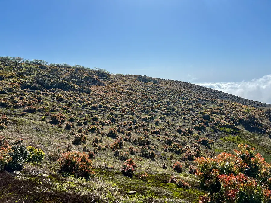
The fresh greenery at this time of year is so beautiful and the scenery is truly moving!
The path continues on a gentle slope for a while, but it can be dangerous if you become too engrossed in the scenery, so make sure to watch your step as you go.

About 15 minutes from the Enseki Ridge/New Trail Junction you will arrive at the Enseki Ridge/Obachiyama Junction.
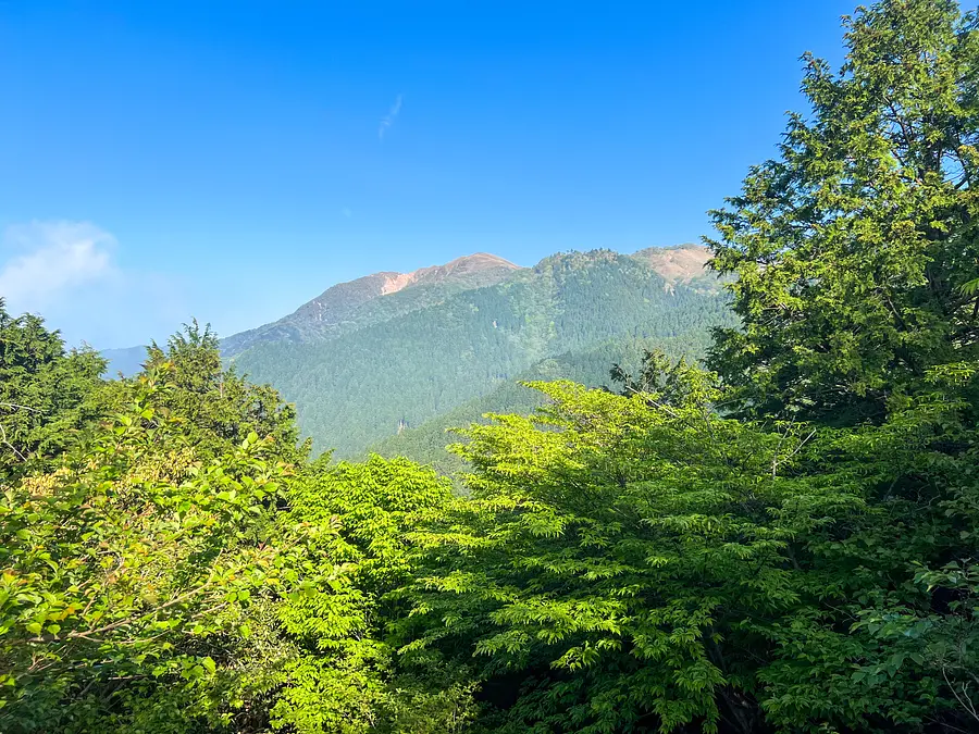
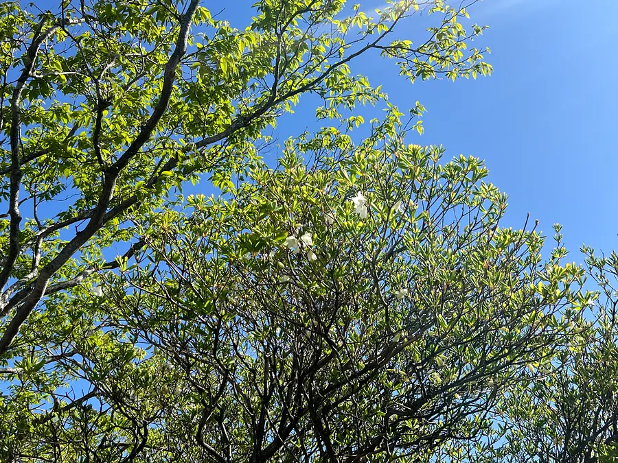
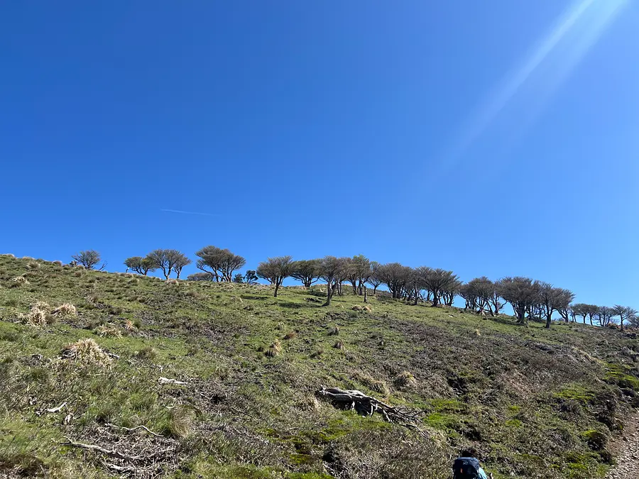
If you continue on from the Excursion Ridge/Obachiyama junction, you will emerge from the forest and reach a ridge from which you can see all the way to the peak of Ryugatake.
Just after emerging from the forest, the path narrows in parts of the ridge, so please take care when passing through.
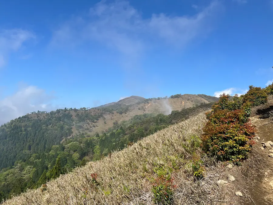
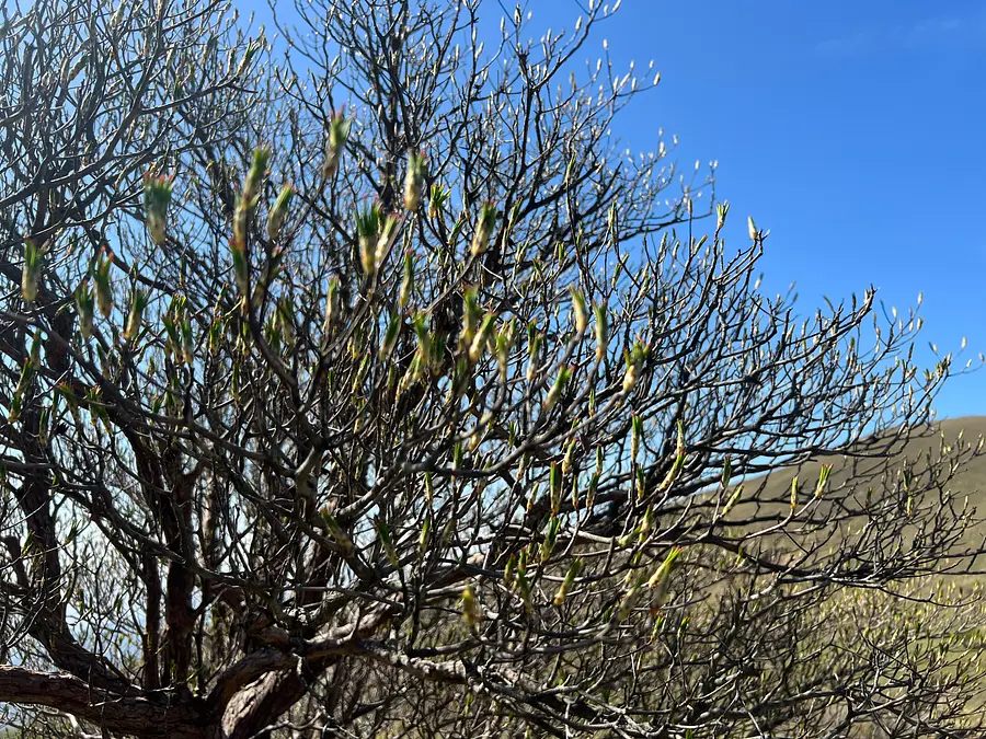
From here, we walked along the ridge with a great view. As we made gentle ascents and descents, we suddenly noticed a white rhododendron tree passing by! (However, there were no rhododendrons in bloom here...)

As I was searching for a tree in bloom, I discovered a white rhododendron in bloom!!
The place where the flowers bloomed is around climbing position confirmation number 126 on the Ugakei hiking map. I feel like I met a lamb ♪
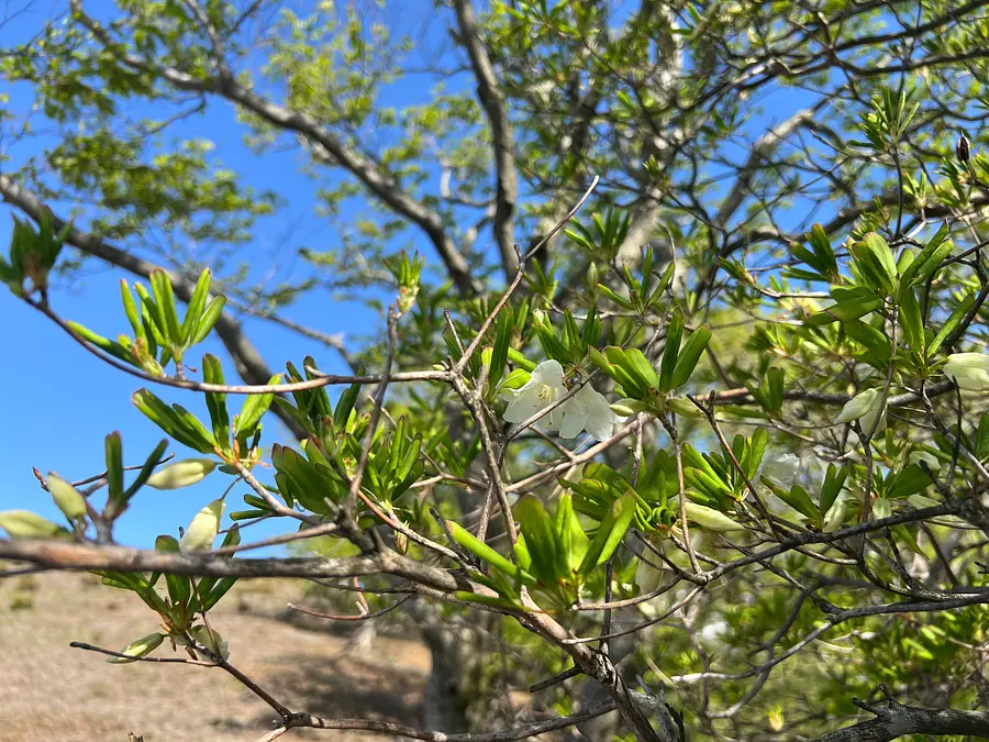
If you want to enjoy the white rhododendrons, please enjoy them from the hiking trail!
If you stray from the hiking trail, you risk falling or getting lost. Also, stepping on the base of the Shiroyashio trees can cause them to wither and die. Be sure to enjoy the Shiroyashio flowers blooming here and there like sheep from the hiking trail!
[Flowering Information (as of May 16, 2024)]
The latest flowering status of the white rhododendrons seems to be that they are partially in full bloom on the middle slope. The best time to see them near the summit is expected to be around the end of May!
Also, many Asebi flowers bloom at this time of year.
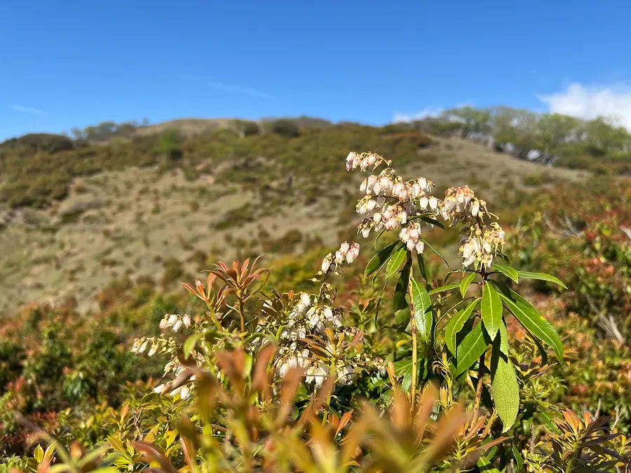
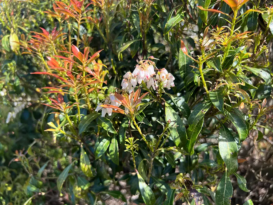
The leaves may look red, but they are actually new shoots! The wonder of seeing autumn leaves in the season of fresh greenery is one of the joys of this season.
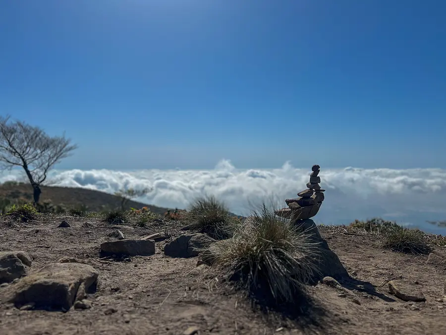
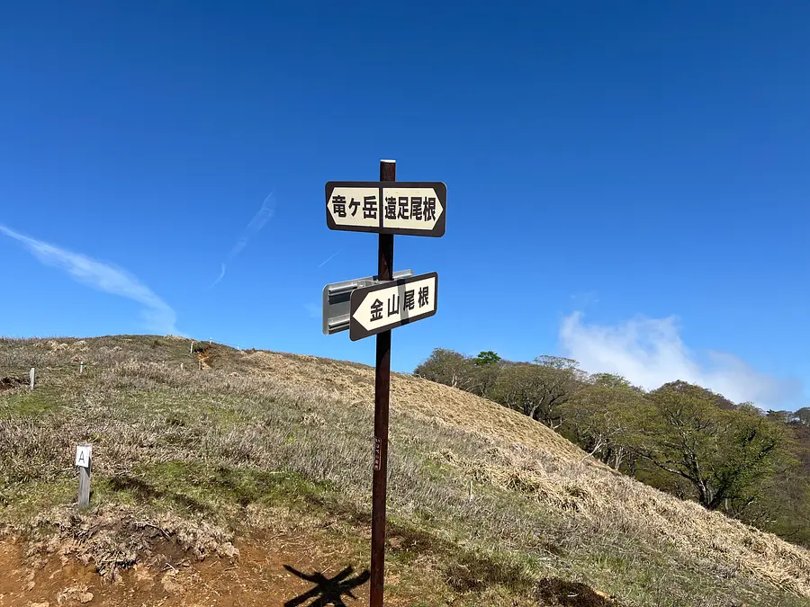
After walking for about 30 minutes from the Ensoku Ridge/Oobachiyama Junction, you will arrive at the (new) Ensoku Ridge/Kanayama Ridge Junction. At an altitude of 980m, you will be higher than the clouds!
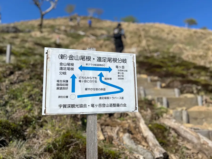
(New) At the Excursion Ridge/Kanayama Ridge Junction, there is a traverse trail (a trail that moves almost horizontally along the mountain slope). Please choose a trail that suits your physical condition.

When you reach the Jita Pass Junction, you will finally reach an altitude of over 1000m. The wind will start to get stronger from this point onwards, so please be careful of your equipment.
Also, there are many white cherry trees in this area that are still noticeable, with new buds just emerging.
When you see the gentle ridgeline, you'll soon be at the summit. The slope is gentle, but the wind will gradually get stronger, so be sure to keep your balance and walk steadily.
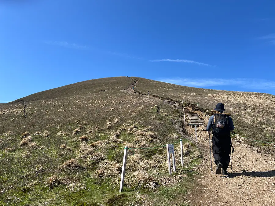
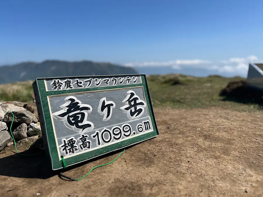
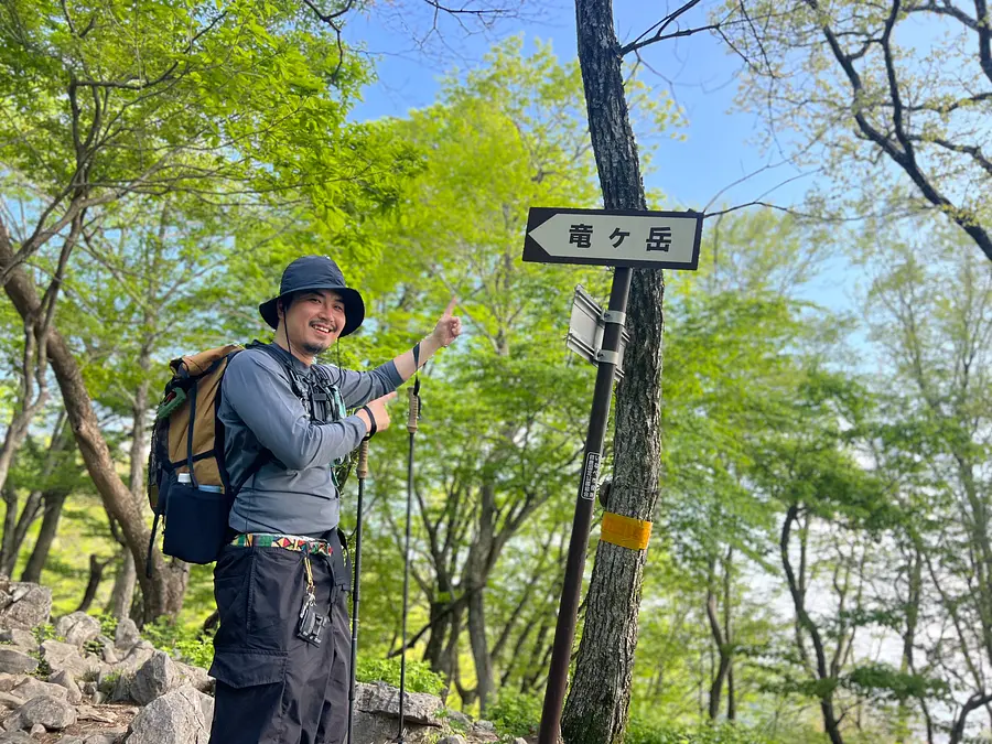
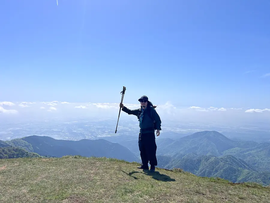
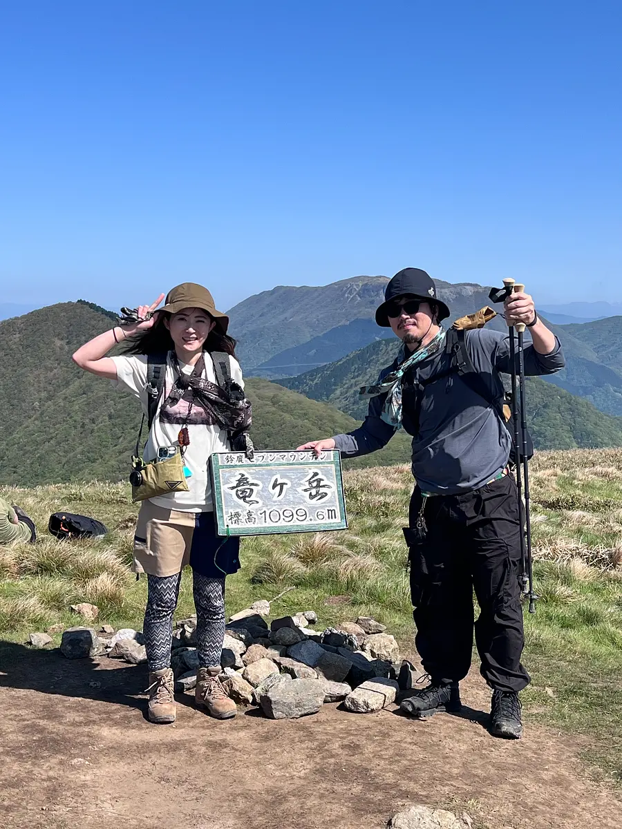
About three hours after we started, we arrived at the summit of Ryugatake Mountain at an altitude of 1,099m! Thank you for your hard work!
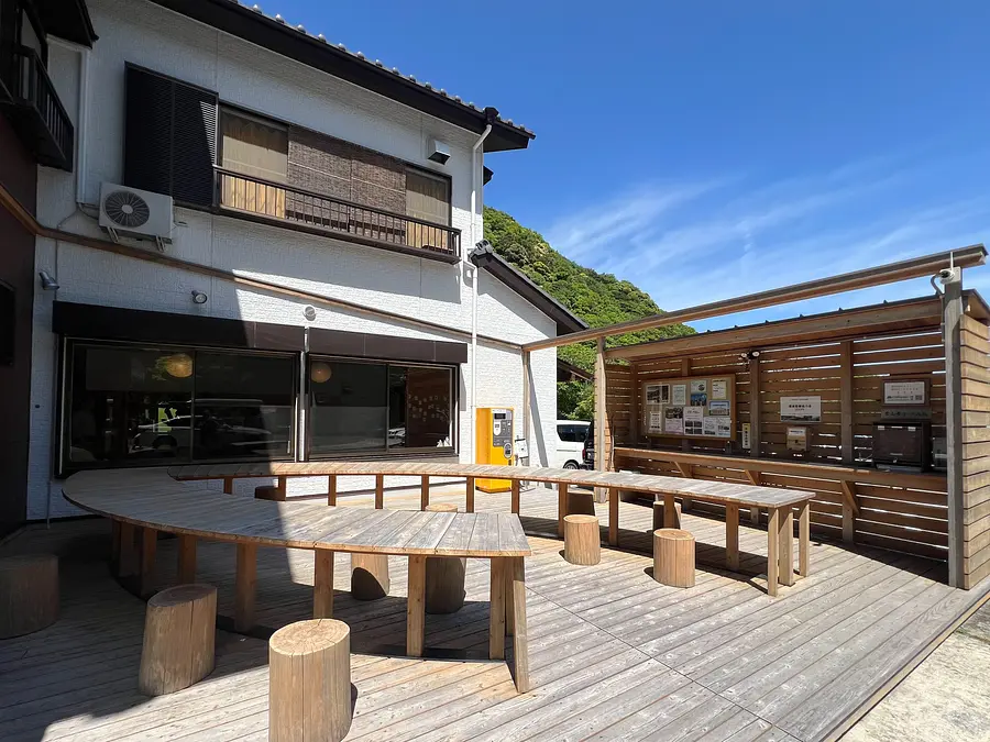
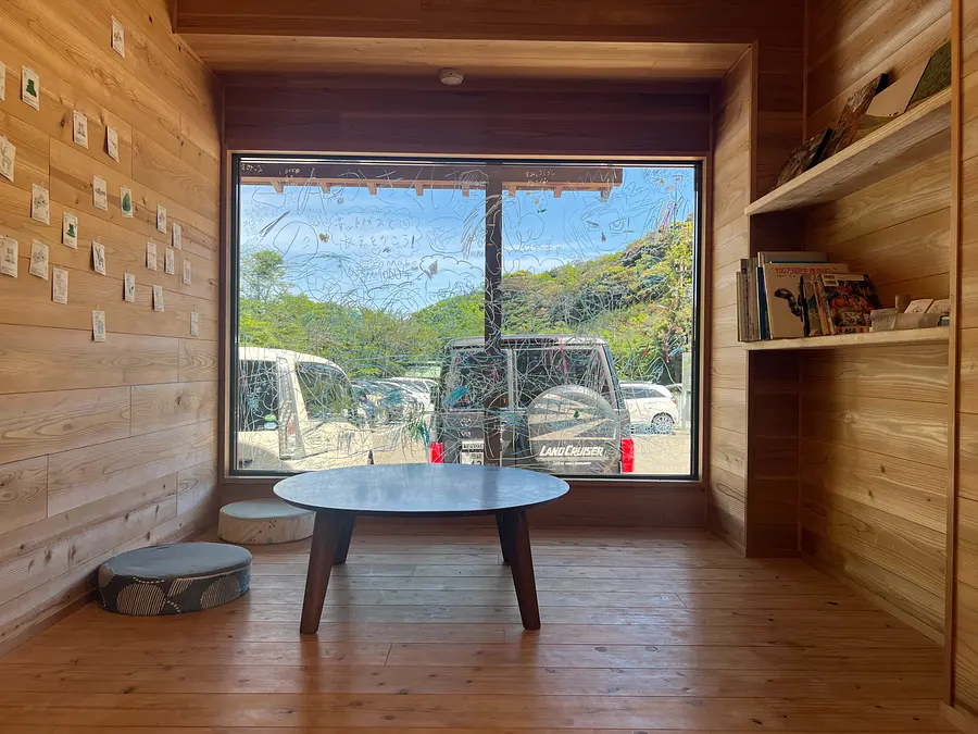
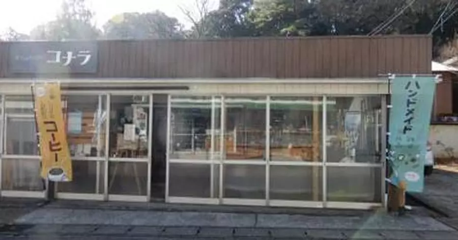
If you come to Ugakei for sightseeing, be sure to visit this place! Let us introduce you to "Ryu no Koba"!
At the entrance to the hiking trails to Ryugatake, the Ugakei Promenade, and the Sand Mountain, there is the Ugakei Tourist Information Center "Tatsunokoba" operated by the Ugakei Tourist Association.
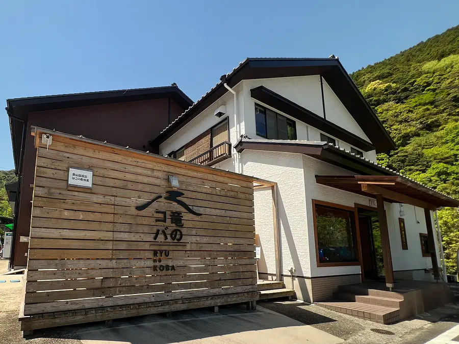
Koba means a small place or a timberland, and refers to a place where people who have crossed the mountains take a rest.
Ryunokoba serves as a resting place for people climbing Mt. Ryugataka, walking along the Ugakei promenade, and visiting Ugakei, and also provides information about Ugakei's nature and tourism.
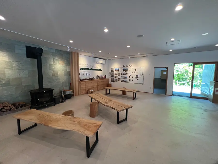
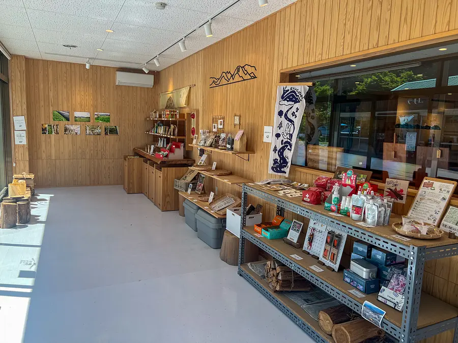
The facility also has toilets, a rest area, and a cafe. In the rest area, you can get information on Ugakei's natural spots, hiking information, and the best time to see flowers along the hiking trails.

There are also notices posted about the activities of the Ryugataka Mountain Trail Maintenance Association, as well as the Ryugataka/Ryunomichi Regeneration Project and the Promenade Regeneration Project, which are being carried out with the support of YAMAP.
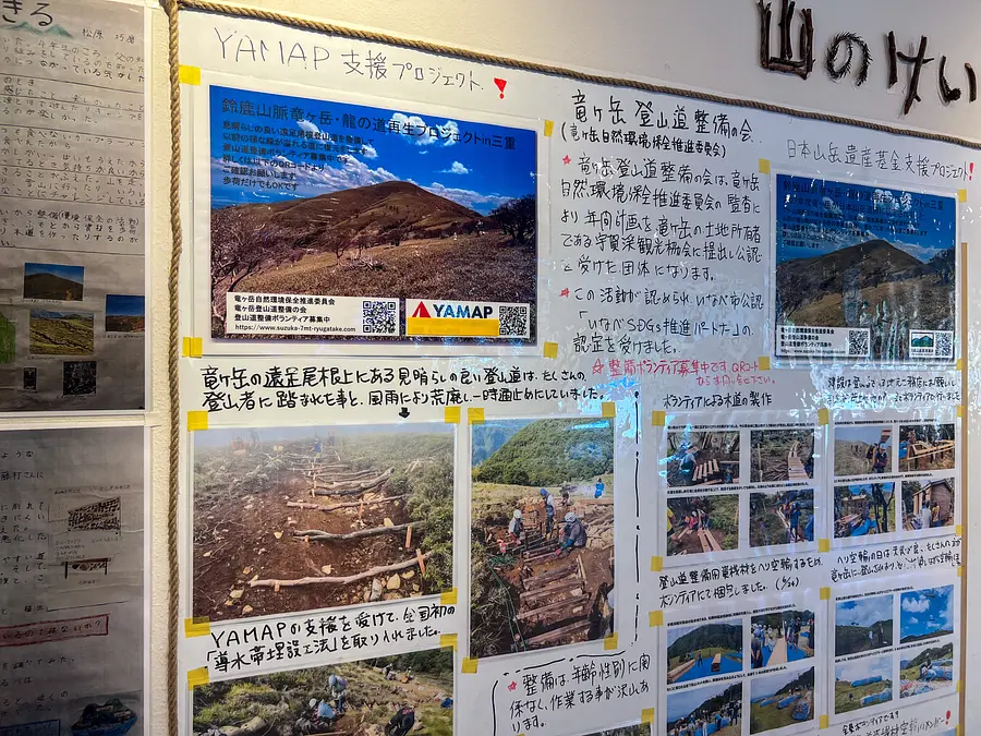
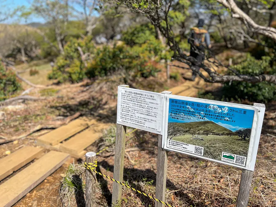
To ensure that the beautiful nature of Ugakei continues forever, various activities are being carried out, such as the construction of hiking trails and walking paths, signposts, and vegetation protection. We are collecting donations to support these activities.
The donation box is located in the outdoor rest area of Ugakei Tourist Information Center, Ryunokoba.

If you come to visit Ugakei, we would appreciate your cooperation in contributing to the environmental improvement project!
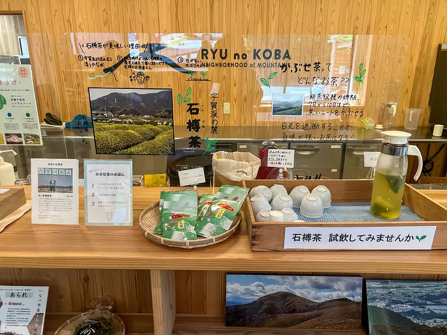
In the cafe space, you can enjoy drinks and soft serve ice cream made with Ishiguro tea, a local specialty.
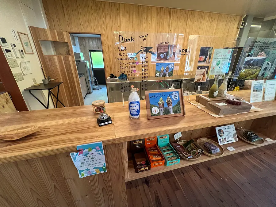
This time, we had spice soda and kabusetea soft serve ice cream, made with the cafe's special original syrup!
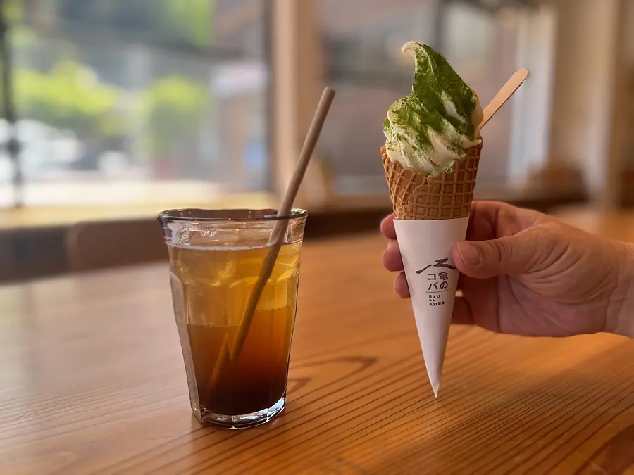
As stated on the menu, the spice soda had a strong ginger flavor that reminded me of cola, and it was delicious, soothing my tired body after a long day of hiking! kabusetea soft serve ice cream was also delicious, with a mellow taste that combined the fragrant flavor of tea with the soft serve ice cream made from ouchiyama milk!
Ishigure tea, a specialty of InabeCity, is served in the cafe space. It is also available for purchase in the sales space, so you can enjoy delicious tea at home!
If you come to Ugakei, be sure to stop by Ryunokoba!
If you want to know more about Ryukoba, check out this article!
Information on recommended spots around Ugakei!!
There is a place like this!
How was it?
We have brought you information on hiking in Ryugatake, where you can enjoy the large flocks of white sheep and the white rhododendrons. During this visit, we were not able to encounter any flocks of sheep, but we were able to confirm that the white rhododendrons were in bloom. The sheep have definitely come to Ryugatake!
According to information, the white rhododendrons are usually in full bloom around mid to late May, and it looks like they will probably be in full bloom around the same time this year too.
Information on when the white rhododendrons are blooming can be found on the bulletin board at Ugakei Tourist Information Center and on the Ryunokoba website, so be sure to check the weather as well!
Detailed information
20.2km (about 35 minutes) from Higashi-Meihan Expressway “Kuwana IC”
29.2km (about 40 minutes) from Meishin Expressway "Yokaichi IC"
Parking: 160 spaces
<Parking fee (per day)>
Large bus (reservation required): 4,000 yen Small bus: 2,000 yen Regular car: 500 yen Motorcycle: 200 yen